A Gameworld of Steampunk and Fantasy
Would you like to react to this message? Create an account in a few clicks or log in to continue.


A gameworld where steampunk and fantasy unite.
 
HomeLatest imagesSearchRegisterLog in


 Map of Midland

Go down 
AuthorMessage
Big Boss
Admin
Big Boss


Posts : 152
Join date : 2018-07-24
Age : 36

Map of Midland Empty
PostSubject: Map of Midland   Map of Midland I_icon_minitimeSat Jun 26, 2021 6:50 pm

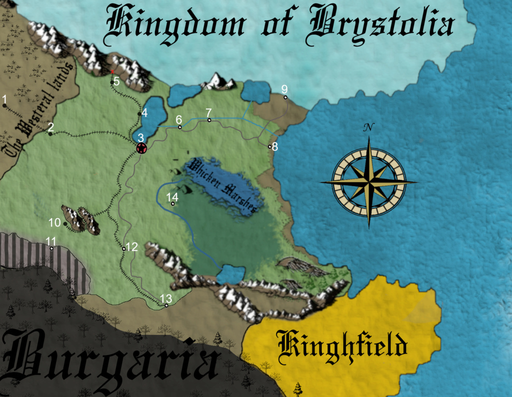
Updated July 8, 2021

Cartography is an important aspect of Midland society, ensuring travelers of all kinds the danger's or sights around the realm. Local maps are credited for the intention of locating points of interest, while political maps will display borders between other countries or kingdom's.


Meles Local Map
This local map represents important locations in-game.

Map of Midland Meles215


Map Key:

1 - Crawsburg City

2 - Heywood Fiefdom

3 - Meles City, Capital

4 - Kensington Fiefdom

5 - Arkmunster Fiefdom

6 - Lonnoi Borough

7 -Dawlish Borough

8 - Port Bildgeburg/ Free Bildgeburg

9 - Northern Border

10 - Haverhill Fiefdom

11 - Southern War Border, Fort Defiant

12 - M.A.G Depot

13 - Southern Border

14 - Edenberg Fiefdom


X - End of Railroad/ End of the Line

___ - Highway's

___ - River's or stream's

___ - Railway Line's
Back to top Go down
https://midland-steampunk.forumotion.com
 
Map of Midland
Back to top 
Page 1 of 1

Permissions in this forum:You cannot reply to topics in this forum
A Gameworld of Steampunk and Fantasy :: Midlandpedia-
Jump to: